Kayak Launch Location
![]()
![]()
Directions
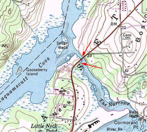
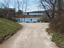
Narrow River DOT Boat Ramp: (CRMC designation n/a) Directions to site is from either north or south on Rt 1A. From the north on Rt 4/ Rt 1, take Rt 138 east, and exit before the Jamestown Bridge onto Rt 1A south. From the south, use the Narragansett exits and drive north on Rt 1A. The public access site owned by the Rhode Island Department of Transportation is just west of the new Route 1A bridge, on the north side of the Narrow River inlet. The boat launch ramp in very poor condition, better suited to hand launching. Parking is available for about 20 cars along the dirt access road parallel to Rt 1. There are no santary facilities but a wooded area provides discrete privacy. This site is used for easy access to the mouth of the Narrows, a good site for surf kayaking.
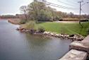

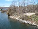
Old Sprague Bridge: East of new Rt 1A bridge is the site of the Old Sprague Bridge. The bridge abutments provide a view of the Pettaquamscutt Refuge and the Narrow River. On the south side of the river, a parking lot is available for about 20 cars. The grassy bank is not suitable for kayak launching because of the large riprap, but behind the parking lot is a somewhat steep path through a wooded area to the water.