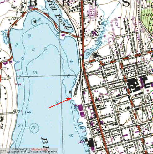
Kayak Launch Location
![]()
![]()
Directions
Independence Park Bristol: (CRMC designations: all street ends in this area, ex. Bradford, are public access) Directions from South: From Rt 136 or Rt 24, cross north on Mt. Hope Bridge. Follow Rt 114 into Bristol. Take 1st left on Constitution, and right onto Thames. Boat ramp at the north end of the Park, across from SS Dion Restaurant. Directions from Providence: Take RT 114 through Barrington, Warren and into Bristol. Ramp will be on right at north end of Park. If coming from north on Rt 136 (less traffic sometimes), take a right (west) either of Gooding Ave or Chestnut St to meet up with Rt 114 south.
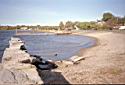
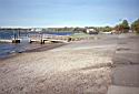
This is an open, grassy town park on the shores of Bristol Harbor, off Thames Street, between the extensions of Franklin and Oliver Streets. There is a wide, concrete road parallel to the shoreline, with room for parking. The shoreline has a rock wall used for fishing, and a gravel beach area which serves as a wide boat-launching area. There is parking for vehicles with trailers adjacent to the beach. This park is the southern end of the East Bay Bicycle Path. There are no public restrooms in the area.