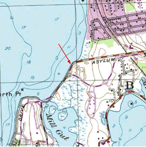
Kayak Launch Location
![]()
![]()
Directions
Colt State
Park, Bristol: (CRMC designation State owned) (Note: The location
of the red dot is slightly in error on the previous map.) Located off
Route 114 and fronting the upper part of Narragansett Bay and Mill
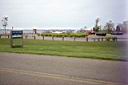
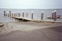
Gut Pond and Salt Marsh. The new launch facility (newer than the topo
map or aerial photos) has a large parking lot and twin concrete
launch pads with a dock between them. The launch site is well marked
when entering the Park, and has portable toilets in the parking lot.
(They were missing during the week one time. Maintenance?) The lot
has parking for mostly trailers but there is space for a dozen
cars
This State Park has large expansive lawns gently sloping
down toward the Bay. A two-mile promenade along the park's seawall is
popular with strollers and joggers. From the promenade and other
vantage points, Colt State Park offers sweeping views of the Bay, of
Prudence Island to the west, and of Mill Gut Salt Marsh to the east.
There is a loop road with numerous pull-offs and picnic areas as well
as plenty of room for a wide variety of recreational activities. A
passenger ferry runs from the north end of the park to Potter Cove on
Prudence Island on weekends during the early summer and daily in
midsummer. The Coggeshall Farm Museum is located off the eastern side
of the loop road.