Dutch Island, Narragansett Bay
For detailed views, click on shaded areas of map. Detailed maps will contain red dots linked to photos at that respective location. The detailed maps are linked together by clicking at the edge of the map in the direction you want to move. Clicking on an edge away from the Island returns to this Index Map. Clicking on any of the text legends also returns to this Index Map.
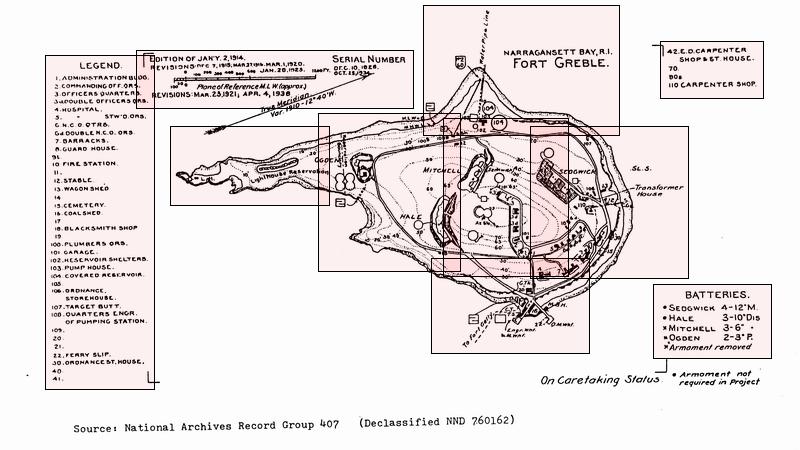
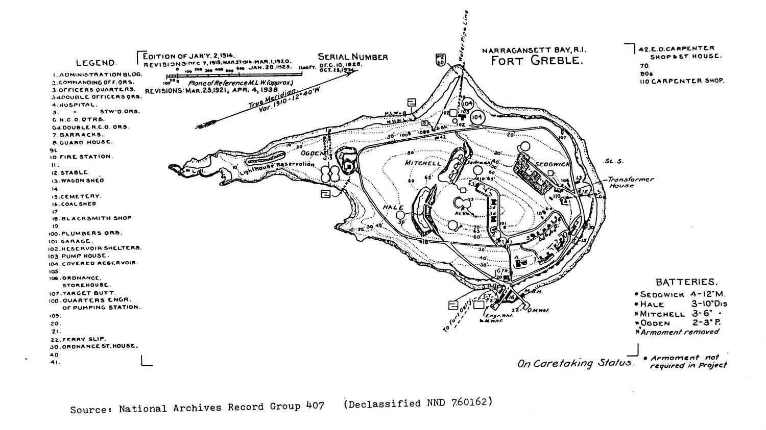
Dutch Island Map from “Defenses of Narragansett Bay in World War II”, by Walter K. Schroder.*
Dutch Island is currently heavily overgrown with dense vegetation. Most of the foot paths and roads are obscured and confused with deer trails on the island. Mature and well fed deer populate the island, consequently the area is infested with deer ticks. The remaining structures on the Island are over 100 years old. The main defenses were built up in 1898 during the Spanish American War and deactivated in 1906. They were activated again for WWI and maintained until WWII where the island was used as a rifle range. Fort Greble was decommissioned in 1947. It is currently maintained by the Rhode Island Department of Environmental Management. The lighthouse on the southern tip of the island was licensed from the Coast Guard to the American Lighthouse Foundation in April 2000. The island has been investigated by the EPA for asbestos and PCB's, but no immediate risk or cleanup is pending. The Island was closed to the public in November 2000, citing danger to the public from vandalism of safety equipment.
Links to other maps: [Location in Narragansett Bay] [USGS topo of Dutch Island] [Larger Scale Army Map] [1995 Aerial Photo (200k)] [1997 Aerial Photo (900k)] [Color Satellite (170k)]
*Published by the Rhode Island Bicentennial Foundation, 1980. Get this book for your home library. Recommended reading for anyone who kayaks or sails in Narragansett Bay, and has the curiosity to wonder what they are seeing or not seeing. A second more detailed book by Walter K. Schroder published in 1998 is “Dutch Island and Fort Greble”. Both have lots of photos and maps that show how much the islands and fortifications have changed over the years.
Last revised 10-9-2005